 Our pick
Guides
Language
EnglishCurrency
US dollar · $Prices on GetYourGuide appear in your chosen currency.
Guide · Walks and history
Old Tokaido road in Hakone: stones, cedars and a teahouse
The old Tokaido road in Hakone was once the hardest stretch of the highway between Edo and Kyoto. Today it is one of the best half-day walks in Japan, through cedar forest to a lake.
Check availabilityfrom $50 · free to cancel
Editorial team, hakone-tour.comUpdated October 22, 2026about 6 min to read51 sources
Quick answer
- 01What it is
- Part of the Edo-period Tokaido, 32 km from Odawara to Mishima.1
- 02The walk
- Near Hakone-Yumoto to Lake Ashi: about 7 km, 2 to 3 hours.2
- 03Original stones
- Only 2 km of the original pavement remains.3
- 04Stops
- Hatajuku, Amazake Chaya, the cedar avenue, the checkpoint.
- 05Guided
- A half-day small-group hike from Hakone-Yumoto Station.
The hardest stretch of the old highway
The Tokaido was the great road of the Edo period, linking Edo, today's Tokyo, with Kyoto. Its section over the Hakone mountains, known as the Hakone Hachiri, ran 32 km from the Odawara post station over the Hakone pass to the Mishima post station.1 Visit Kanagawa describes the part between Mishima and the Hakone checkpoint, over a pass at 846 m, as the most grueling part of the whole highway.4
Before the stones, travellers waded through knee-deep mud whenever it rained or snowed. The road was first paved with local Hakone-dake bamboo, which rotted and had to be relaid at great cost.5 The shogunate then spent 1,400 ryo paving 10 km of the road with stone.6 The stretch behind Amazake Chaya was paved in 1680, having been a dirt path before.7
Only 2 km of that original pavement remains, and walking the old Tokaido road in Hakone today means stepping on stones that Edo travellers knew.3 Rounded, mossy and slippery when wet, they are uneven enough to make you understand why this was a hard day's walk.
The half-day hike
Hakone-Yumoto to the checkpoint
-
Start
Hakone-Yumoto Station
Meet the guide at the ticket gate.
-
First hour
Sukumo River
A 15-minute taxi, then a 1-hour walk.
-
Next
Hatajuku
30 minutes in the marquetry village.
-
Mid-hike
Amazake tea house
30 minutes for amazake by the fire.
-
The best part
Cobbled Tokaido
45 minutes on the old paving stones.
-
Finish
Cedars and checkpoint
Lake Ashi, the avenue, the gate.
Cedars planted by the shogunate
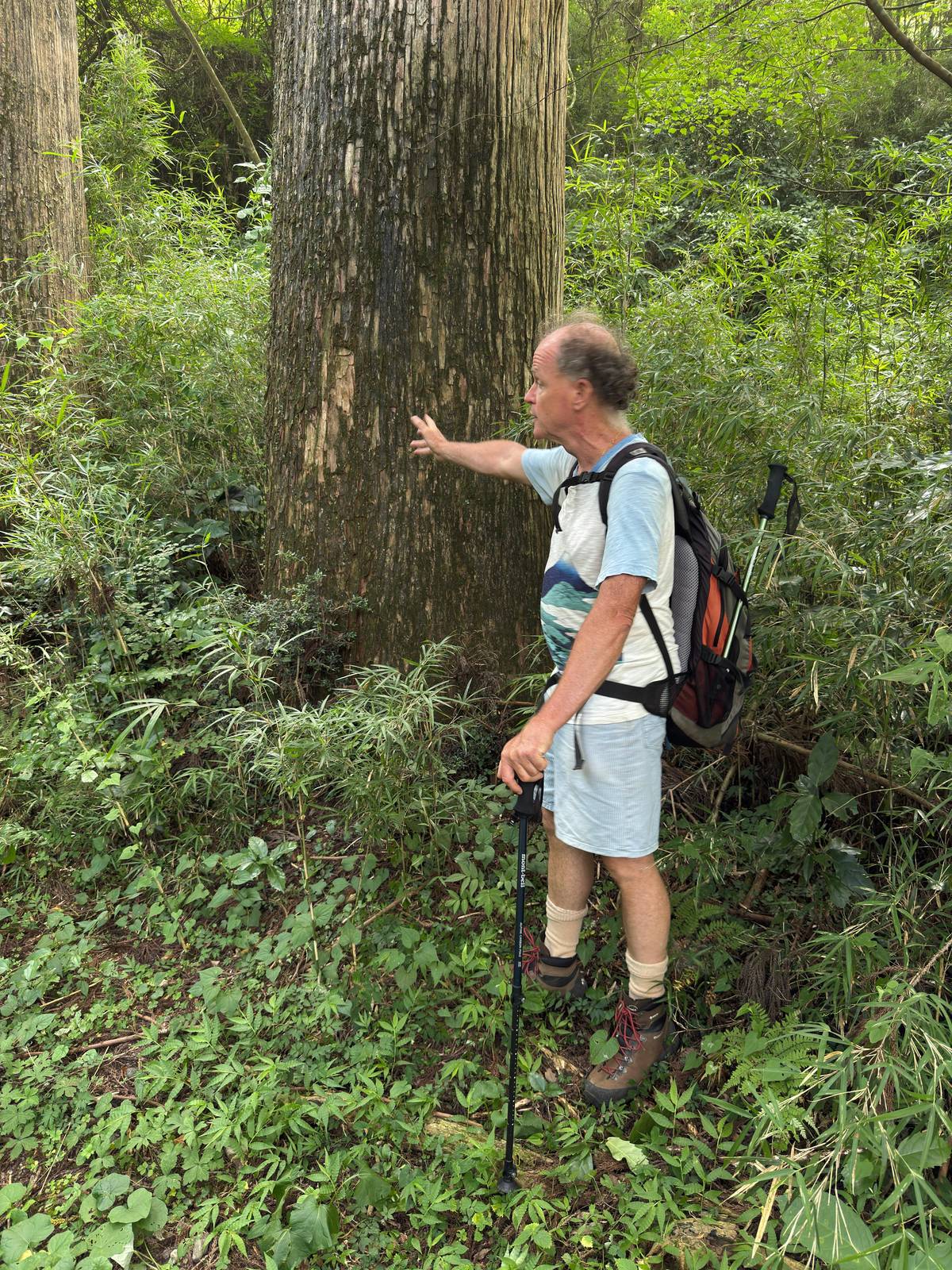
The trees are as old as the stones. In 1604 the new government began planting rows of trees along the major roads, to guide travellers, shelter them and stop people altering the route.8 In Hakone it planted pines at first, but they failed in the wet climate, and in the 1650s they were replaced with cedars.9
About 400 of those original cedars still stand in Hakone.10 Near Lake Ashi some are more than 350 years old and 30 to 40 meters tall.11 The avenue is at its most atmospheric in light rain or mist, when the trunks fade into grey.
Walk it slowly and look up. The canopy closes over the path, the air is cool even in summer, and the old road and the modern one run side by side, so you can step from the Edo period into traffic and back in a few paces. Listen, too: in the quieter stretches the only sounds are water running beside the path and the knock of your boots on stone, much as an Edo traveller would have heard it.
Guided options
Three guided walks compared
| Walk | Hours | Group | Ends at | From |
|---|---|---|---|---|
| Half-day hike | 3.5 | Up to 6 | Hakone Checkpoint | $112 |
| Full-day hike | 7 | Up to 6 | Mishima Station | $166 |
| Private hike with tea ceremony | 8 | Private | Mishima Station | $445 |
As each listing states; these are starting prices, and the private walk may be priced for the whole group.
Walk with a guide
Half day, full day or private
Our pick Longer walk
 Private
Decision helper
How should you walk the old road?
Choose by time, fitness and company
The half-day hike
3.5 hours from Hakone-Yumoto Station to the checkpoint.
The full-day hike
About 5 to 6 hours of walking, ending at Mishima.
The private hike
A private group with a tea ceremony on the way.
Walk it yourself
About 7 km near Yumoto to the lake, rated moderate.2
Walk uphill only
Descending is easier but tough on the knees.12
The Edo Shogunal government spent 1,400 ryo to pave the road with stone for 10 km of the road.
Amazake Chaya, Hatajuku and the checkpoint
After the Hakone Checkpoint was established in 1619, four teahouses sprang up in the Oidaira area to serve exhausted travellers climbing from the coast.13 Only Amazake Chaya survives, the others having closed once a new road, today's National Route 1, drew the traffic away in the late nineteenth century.14 Its thatched building was reconstructed in 2009 using old materials, and it has been run by 12 successive generations since the Edo era.1516 It serves sugar-free amazake, a sweet fermented rice drink, and opens from 7am to 5:30pm every day.17
Hatajuku, lower down, is the birthplace of yosegi marquetry, the mosaic woodwork of Hakone, and about a dozen craftspeople still work there.18 Its reconstructed ichirizuka mounds marked 23 ri from Edo, each ri being 3.93 km.19 The Hatajuku Parquet Hall sells marquetry and runs hands-on classes.20
At the lake end stands the Hakone Checkpoint, rebuilt from an 1865 restoration report found in 1983 and open to visitors since April 2007.21 The museum beside it shows 300 historical items, and the site is open from 9:00 to 17:00, last admission 16:30.2223 Visit Kanagawa lists adult admission at 500 yen.24
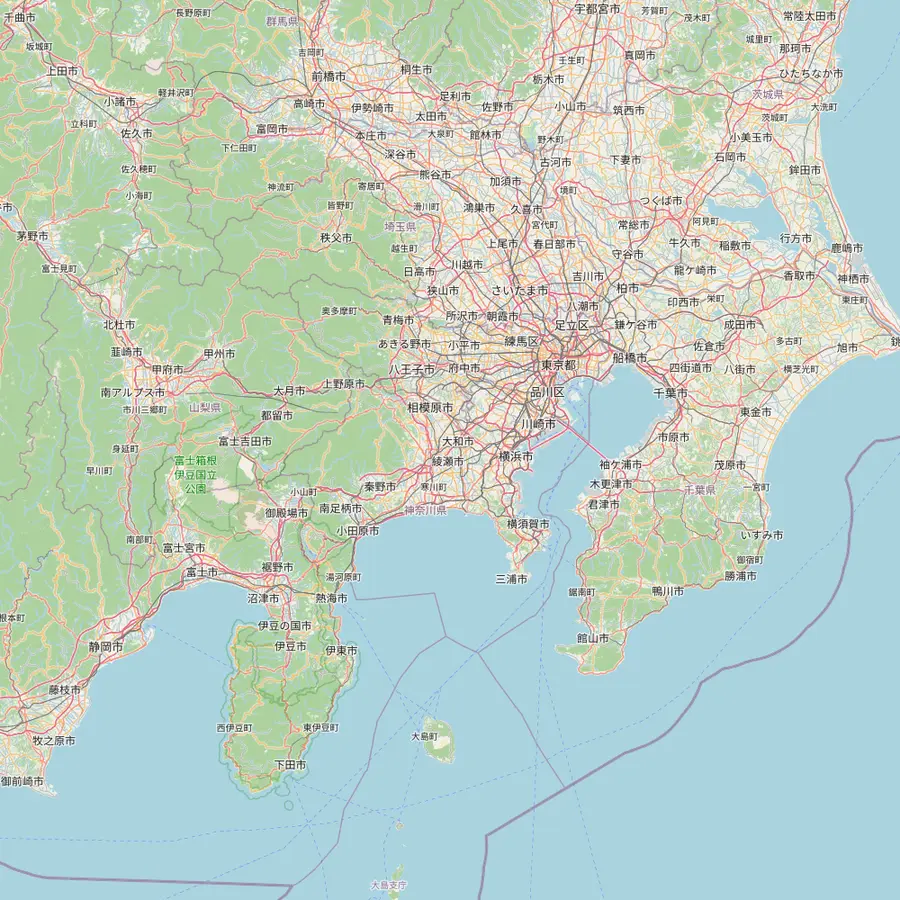
Map
Hakone, the Tozan line and the old road
The whole valley first, then the railway climb to Gora, the streets around Yumoto station, the cedar road over the pass and the way in from Tokyo.
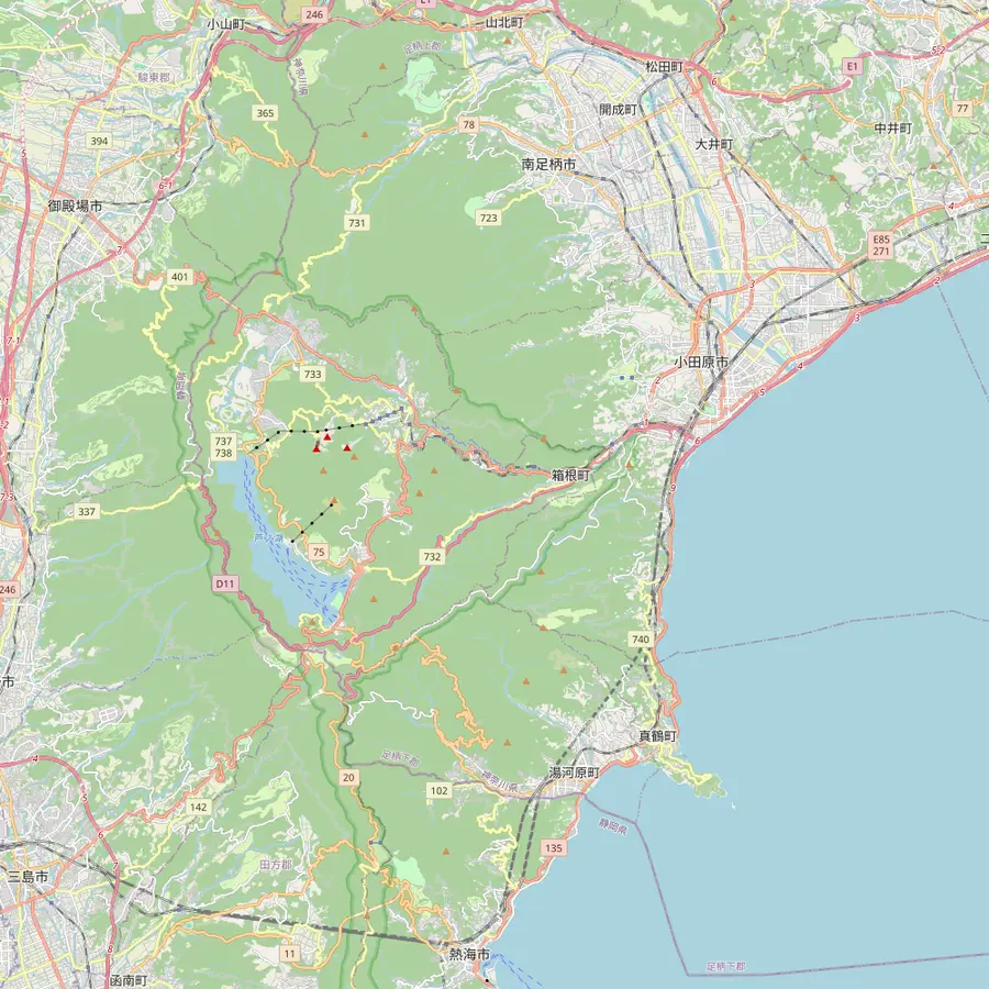 1Yumoto Station2Hakone Open-Air Museum3Owakudani4Sengokuhara5Hakone Checkpoint
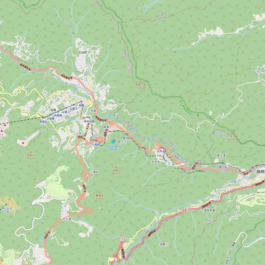 6Tonosawa Station7Ohiradai Station8Miyanoshita Station9Kowakidani Station10Chisuji Falls11Gora Station12Hakone Gora Park13Sounzan Station
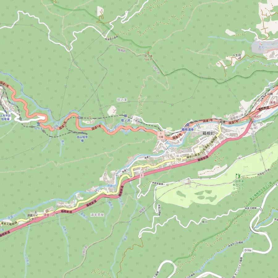 14Sounji Temple15Tenzan bathhouse16Amidaji Temple
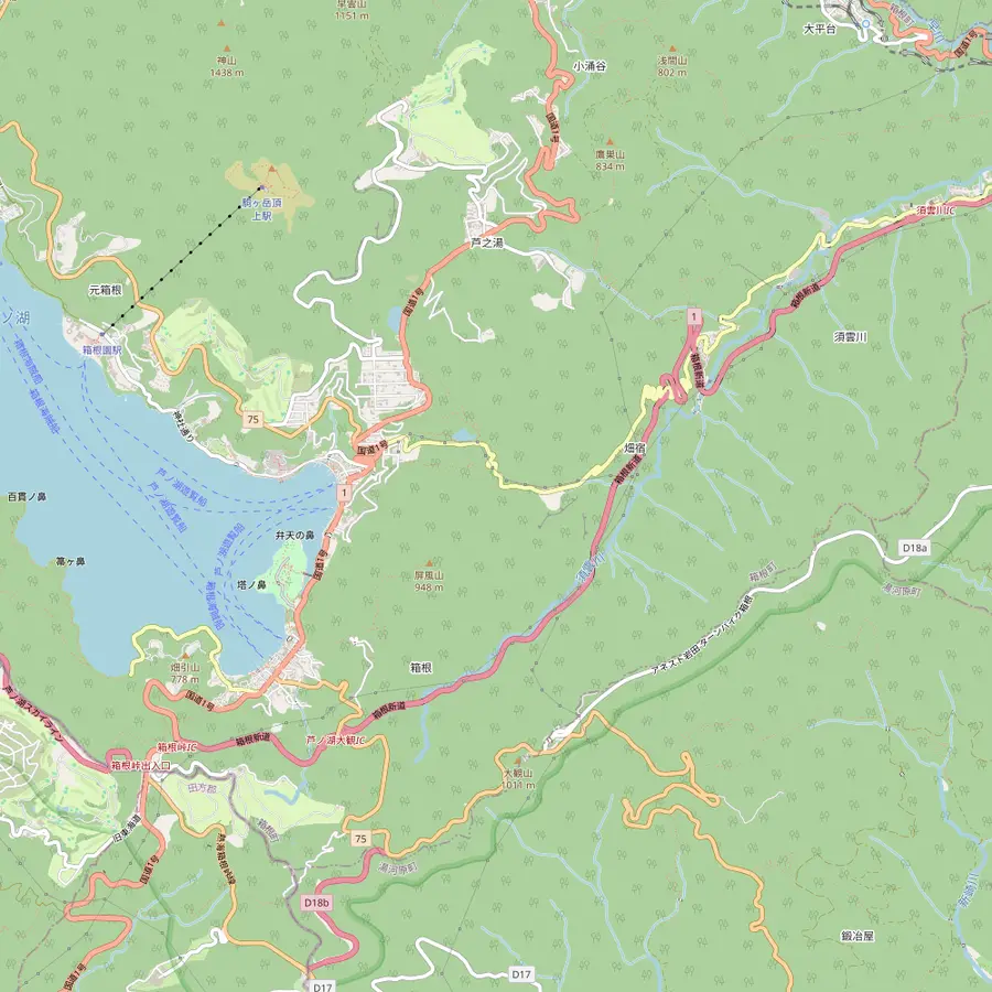 17Hatajuku18Amazake Chaya19Old Tokaido cedar avenue
 20Shinjuku Station21Odawara Station
- 1Yumoto Station
The limited express from Shinjuku ends here after about 80 minutes; platform 3 is for the Tozan Railway up to Gora.2526
In Google Maps ↗ - 2Hakone Open-Air Museum
Sculpture park opened in 1969, a 2-minute walk from Chokoku-no-Mori Station on the Tozan line.2728
In Google Maps ↗ - 3Owakudani
A stop on the day tour this site sells, reached on the Hakone Ropeway.
In Google Maps ↗ - 4Sengokuhara
Highland area with silver grass plains in autumn; express buses run here from Shinjuku in about 2 hours.2930
In Google Maps ↗ - 5Hakone Checkpoint
Reconstructed Edo-period checkpoint, open to the public since April 2007, with a museum of 300 items.2122
In Google Maps ↗ - 6Tonosawa Station
First stop above Yumoto; a path of no more than 20 minutes leads up to Amidaji.31
In Google Maps ↗ - 7Ohiradai Station
One of the switchbacks where the train reverses to keep climbing.32
In Google Maps ↗ - 8Miyanoshita Station
Village of the Fujiya Hotel, developed as a summer retreat from Tokyo and Yokohama.33
In Google Maps ↗ - 9Kowakidani Station
Chisuji Falls is a 20-minute stroll from here.34
In Google Maps ↗ - 10Chisuji Falls
Water threads down a mossy volcanic wall 20 meters wide and 3 meters tall.35
In Google Maps ↗ - 11Gora Station
End of the Tozan line, where the cable car continues uphill.36
In Google Maps ↗ - 12Hakone Gora Park
Garden opened in 1914, a 5-minute walk from Gora Station.3738
In Google Maps ↗ - 13Sounzan Station
Top of the cable car, 209 meters above Gora, and the ropeway transfer.39
In Google Maps ↗ - 14Sounji Temple
Rinzai Zen temple founded in 1521 in honour of Hojo Soun.40
In Google Maps ↗ - 15Tenzan bathhouse
Day-use bathhouse with public baths only, no private bath, and cash payment.4142
In Google Maps ↗ - 16Amidaji Temple
Hydrangeas line its path from late June to mid July.43
In Google Maps ↗ - 17Hatajuku
Village of yosegi marquetry, with reconstructed milestone mounds that marked 23 ri from Edo.1819
In Google Maps ↗ - 18Amazake Chaya
Thatched teahouse run by 12 generations, open 7am to 5:30pm.1617
In Google Maps ↗ - 19Old Tokaido cedar avenue
Cedars more than 350 years old, some 30 to 40 meters tall, line the old road by the lake.11
In Google Maps ↗ - 20Shinjuku Station
Odakyu limited expresses leave here for Hakone-Yumoto, about 80 minutes away.25
In Google Maps ↗ - 21Odawara Station
Shinkansen stop; from here the Odakyu line reaches Hakone-Yumoto in 15 minutes.44
In Google Maps ↗
Checklist
For the old road
01
Wear
- Sturdy hiking shoes, not trainers
- Rain gear: the stones get slick
- A layer for the shaded forest
02
Carry
- Cash for the teahouse and buses
- The last bus time at the teahouse
- Water and a snack
Cost calculator
Price a guided walk for your group
Enter your group size to compare the shared walks.
People
Total from$223
per guest from $112
Check availabilityfree cancellationTotals take each listing's cheapest GetYourGuide price times the number of travellers, turned into your own currency with the European Central Bank's figure for today; the sum at checkout is the one that counts.
Video
Hakone & Old Tokaido Highway
Nothing loads until you tap play.
Walking it on your own
The Hakone Tourist Association describes the Old Tokaido trail from near Hakone-Yumoto to Lake Ashi as about 7 km in 2 to 3 hours, rated moderate.2 You can also start higher, at Hatajuku or Amazake Chaya, to skip the lower road sections and keep the best of the stone paving and forest.
Visit Kanagawa adds a useful warning: descending is easier than the climb, but tough on the knees.12 The association recommends sturdy hiking shoes on every trail in Hakone and names spring and autumn as the ideal seasons.4546 The stones are slippery after rain, so a pair of poles is worth carrying.
Mind the buses. Amazake Chaya's last bus leaves at 5:10pm, so start early enough to finish with daylight and a bus to spare.17 For Hakone hiking beyond the old road, the Yusakamichi, a ninth-century route from Hakone-Yumoto towards Hakone Shrine, can be walked as a 10.4-kilometer course.47
Guided walks on the Hakone Hachiri
A guide turns the stones into stories. The half-day hike we recommend is limited to 6 walkers, meets at the ticket gate of Hakone-Yumoto Station and lasts 3.5 hours, led in English. Its rating is 5.0 from 5 reviews, and it starts from $112.
Its listed route is a good summary of the whole road: a 15-minute taxi, a 1-hour walk along the Sukumo River, 30 minutes in Hatajuku, a 10-minute bus, 30 minutes at the Amazake tea house, 45 minutes on the cobbled Tokaido, Lake Ashi and the cedar avenue, finishing at the Hakone Checkpoint.
For a longer day, the full version runs 7 hours with about 5 to 6 hours of walking, adds lunch at Lake Ashi and finishes at Mishima Station. It is rated 4.88 from 24 reviews and starts from $166. A private 8-hour version with a tea ceremony also ends at Mishima Station.
When to walk and what to bring
Spring and autumn are the ideal hiking seasons, with mild temperatures and colour in the forest.46 Fall colours in Hakone run from early October to early December, and cherry blossoms from late March to early April.4849 Summer is cooler here than in Tokyo, which makes the shaded cedar sections pleasant even in July.50
Rain is the walker's main enemy, and Hakone is wet. In June, the Japan Meteorological Agency's normals for its Hakone station count 16 days with at least 1 mm of rain, and the stones turn slick quickly.51 Check the forecast, carry rain gear, and turn back if the path runs with water.
Bring water, a snack and cash for the teahouse and the bus. Wear proper shoes rather than trainers; the old paving rolls under a thin sole. Start from Hakone-Yumoto in the morning, and you can finish by the lake in time for a late lunch and a bus back down.
Walk the road or take the coach?
The coach day this site sells does not walk the old road. Its listed stops are Hakone Shrine, the Togendai pier, the ropeway, Owakudani, Lake Yamanaka and Oshino Hakkai. It is the efficient way to see the famous loop; the Tokaido is a different, slower Hakone.
With more than a day, do both: the coach day for the lake and the crater, and a morning on the old road for the forest and the history. If you have one, choose by temperament. If you love history, the stones and the teahouse will stay with you longer than any viewpoint.
Either way, the old road rewards an early start and a slow pace. Leave the timetable thinking to the guide if you book one, and simply walk. Sit at Amazake Chaya with a cup of amazake by the fire, and you are doing exactly what Edo travellers did on the same spot, centuries ago.
Your Hakone day
Shrine, steam and the Fuji lakes in a day.
Pick a date, meet in Tokyo, and cancel free up to 24 hours before.


You ask,we answer.
How long is the walk?
About 7 km, 2 to 3 hours. That is from near Hakone-Yumoto to Lake Ashi, rated moderate by the Hakone Tourist Association.2
How much original paving is left?
About 2 km. The shogunate paved 10 km with stone; only 2 km of the original pavement remains.63
When is Amazake Chaya open?
7am to 5:30pm, every day. Last order is at 5pm, and the last bus from the teahouse leaves at 5:10pm.17
What does the checkpoint cost?
500 yen for adults. Children pay 250 yen; it opens 9:00 to 17:00, last admission 16:30.2423
Is there a guided hike?
Yes, half or full day. The half day takes 3.5 hours from Hakone-Yumoto Station; the full day runs 7 hours.
Sources
The sources for this guide
- 1Visit Kanagawa (Kanagawa Prefectural Government)Hakone Old Highway↩
- 2Hakone Tourist AssociationBest hiking trails in Hakone↩
- 3Visit Kanagawa (Kanagawa Prefectural Government)Hakone Old Highway↩
- 4Visit Kanagawa (Kanagawa Prefectural Government)Hakone Old Highway↩
- 5Visit Kanagawa (Kanagawa Prefectural Government)Hakone Old Highway↩
- 6Visit Kanagawa (Kanagawa Prefectural Government)Hakone Old Highway↩
- 7Hakone Tourist Association (text by the Japan Tourism Agency)Hakone and Old Tokaido highway travel↩
- 8Hakone Tourist Association (text by the Japan Tourism Agency)Sugi Namiki (old highway trees)↩
- 9Hakone Tourist Association (text by the Japan Tourism Agency)Sugi Namiki (old highway trees)↩
- 10Hakone Tourist Association (text by the Japan Tourism Agency)Sugi Namiki (old highway trees)↩
- 11Visit Kanagawa (Kanagawa Prefectural Government)Old Hakone Highway cedar-lined road↩
- 12Visit Kanagawa (Kanagawa Prefectural Government)Old Hakone Highway cedar-lined road↩
- 13Hakone Tourist Association (text by the Japan Tourism Agency)Hakone and Old Tokaido highway travel↩
- 14Hakone Tourist Association (text by the Japan Tourism Agency)Hakone and Old Tokaido highway travel↩
- 15Hakone Tourist Association (text by the Japan Tourism Agency)Hakone and Old Tokaido highway travel↩
- 16Visit Kanagawa (Kanagawa Prefectural Government)Amazake Chaya Teahouse↩
- 17Visit Kanagawa (Kanagawa Prefectural Government)Amazake Chaya Teahouse↩
- 18Hakone Tourist Association (text by the Japan Tourism Agency)Yosegi, Hatajuku and Ichirizuka↩
- 19Hakone Tourist Association (text by the Japan Tourism Agency)Yosegi, Hatajuku and Ichirizuka↩
- 20Visit Kanagawa (Kanagawa Prefectural Government)Hatajuku Parquet Hall↩
- 21Visit Kanagawa (Kanagawa Prefectural Government)Hakone Checkpoint↩
- 22Visit Kanagawa (Kanagawa Prefectural Government)Hakone Checkpoint↩
- 23Visit Kanagawa (Kanagawa Prefectural Government)Hakone Checkpoint↩
- 24Visit Kanagawa (Kanagawa Prefectural Government)Hakone Checkpoint↩
- 25Odakyu Electric RailwayLimited Express from Shinjuku to Hakone: ticket details↩
- 26Odakyu Hakone (hakonenavi)Hakone-Yumoto Station↩
- 27The Hakone Open-Air MuseumAbout Us↩
- 28The Hakone Open-Air MuseumAccess↩
- 29Visit Kanagawa (Kanagawa Prefectural Government)Sengokuhara silver grass fields↩
- 30Hakone Tourist AssociationHow do I go to Hakone?↩
- 31Hakone Tourist Association (text by the Japan Tourism Agency)Amidaji Temple↩
- 32Hakone Tourist AssociationThe Hakone Tozan Train↩
- 33Hakone Tourist AssociationAreas↩
- 34Hakone Tourist Association (text by the Japan Tourism Agency)Chisuji Falls↩
- 35Hakone Tourist Association (text by the Japan Tourism Agency)Chisuji Falls↩
- 36Hakone Tourist AssociationThe Hakone Tozan Train↩
- 37Visit Kanagawa (Kanagawa Prefectural Government)Hakone Gora Park↩
- 38Visit Kanagawa (Kanagawa Prefectural Government)Hakone Gora Park↩
- 39Odakyu Hakone (hakonenavi)Hakone Tozan Train / Hakone Tozan Cable Car↩
- 40Hakone Tourist Association (text by the Japan Tourism Agency)Sounji Temple↩
- 41Tenzan Tohji-kyoEnglish↩
- 42Tenzan Tohji-kyoEnglish↩
- 43Hakone Tourist Association (text by the Japan Tourism Agency)Amidaji Temple↩
- 44Hakone Tourist AssociationJR Railpass and Hakone↩
- 45Hakone Tourist AssociationBest hiking trails in Hakone↩
- 46Hakone Tourist AssociationBest hiking trails in Hakone↩
- 47Hakone Tourist Association (text by the Japan Tourism Agency)Yusakamichi↩
- 48Odakyu Hakone (hakonenavi)Seasonal highlights: winter↩
- 49Odakyu Hakone (hakonenavi)Seasonal highlights: spring↩
- 50Odakyu Hakone (hakonenavi)Seasonal highlights: summer↩
- 51Japan Meteorological AgencyClimate normals (heinenchi), Station Odawara (temperature) and Hakone (rain) (JMA AMeDAS 1008 + 0390), 1991 to 2020↩